Atomionics Opens an Underwater Path for Quantum Gravimetry
Quentir Defense Monitor
Evidence-based insights for quantum defense and security. Published by Quentir Systems LLC · August 3, 2026.
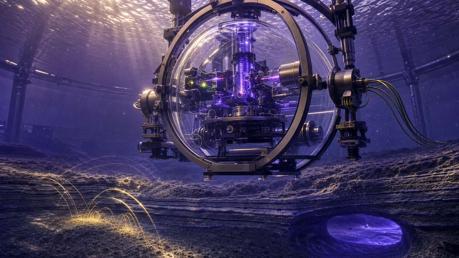
The ocean removes the easy references. Satellite navigation signals do not reach a submerged vessel, seabed infrastructure is difficult to inspect, and ordinary inertial systems accumulate error over time. A Singapore company is building its next quantum-sensing program around that hard environment.
Atomionics opened an integrated quantum-sensing hub on July 31 to adapt its gravity-measurement technology for underwater work. The primary report by Benjamin Cher in The Business Times says the company currently has three sensors and plans to expand development and manufacturing in Singapore. It identifies independent navigation, subsea-infrastructure mapping, and seabed resource surveys as intended applications. The report also records an ongoing partnership with Singapore's Ministry of Defense and Cap Vista for commercial and defense uses.
That makes this a quantum gravimetry story with a clear buyer's question. Atomionics has field evidence for its land system, GRAVIO, and a new place to develop an underwater version. The public record does not yet include an underwater trial, measured performance at sea, or a complete navigation system.
A gravity instrument reads what the eye cannot see
A cold-atom gravimeter measures tiny changes in gravitational acceleration. Lasers cool atoms, then split and recombine their matter waves. Local gravity changes the phase accumulated along those paths, leaving a measurable interference pattern.
Density creates the useful signal. Rock and voids produce gravity anomalies. Tunnels, mineral bodies, or built structures can do so as well. A sensor does not photograph the object. It records a field that analysts combine with position data and geophysical models to infer what distribution of mass could have produced it.
Atomionics says its existing GRAVIO system collects gravity measurements while moving and feeds them into an AI-supported modeling process. The Business Times reports that the system produced a three-dimensional ground model matching 95 percent of exploratory drilling findings. That number is company-supplied and needs its test conditions to be useful in acquisition: survey area, geology, target size and depth, sampling pattern, reference instruments, and the definition of a match all affect what 95 percent means.
There is independent evidence that the apparatus has left a controlled bench. In March, the company reported an urban field proof with Singapore's QSC. The instrument operated from a vehicle along Marina East Drive amid road traffic and vibration above complicated underground structures. The stated purpose was underground-infrastructure detection. The company has not published a detailed performance table on that page. Even so, the test establishes a more demanding environment than a stationary laboratory assembly.
Underwater operation adds different disturbances. Vessel motion and changing attitude; pressure and temperature shifts; vibration; and limited calibration access can all obscure a weak gravity signal. Position uncertainty also matters because a gravity reading has little value if the system cannot locate it precisely. An underwater package therefore has to combine the quantum sensor with motion compensation, stable timing, navigation references, environmental characterization, and an interpretation pipeline.
The defense capability is persistence below the surface
For a force, the attractive capability is GPS-independent awareness over long periods. Gravity is available underwater and cannot be switched off at the source. A sufficiently stable sensor, paired with a validated gravity map and other navigation instruments, could provide observations that constrain accumulated position error. It could also contribute to surveys of seabed terrain and changes around critical underwater infrastructure.
The value is defensive when a navy or coast guard protects its own navigation resilience, harbor approaches, cables, pipelines, or seabed installations. It can support civil hydrography, resource exploration, construction, and infrastructure maintenance as well. The same ability to infer hidden mass distributions can serve intelligence and search missions. That combination makes the published development dual-use: commercial operators and public agencies gain subsurface information, while defense users gain a sensor whose utility grows where satellite and visual references disappear.
Public evidence supports the broad mission fit. A UK government assessment of Singapore's quantum sector identifies quantum sensing for defense as a collaboration opportunity and highlights PNT. It also describes Singapore's sensing projects as early in development and notes limited field-trial evidence. That fits the Atomionics record: land demonstrations exist, while the underwater program is still framed as adaptation work.
The distinction between gravity mapping and inertial navigation is important. A gravimeter measures gravity. A complete inertial navigation system also needs acceleration, rotation, timing, initialization, error estimation, and a method for comparing observations with a trusted reference. Gravity-aided navigation may use local variations as fixes or constraints, yet the hub announcement does not specify such an integrated architecture. Buyers should read “navigation” as an intended system application rather than a demonstrated function of the new underwater package.
The sensing advantage also comes with a symmetry. Gravity fields are passive and persistent. A user can collect them for protective mapping or commercial surveying, while another user can study concealed structures or environmental changes. Public sources do not establish detection range, discrimination performance, or suitability against any military target. They establish a dual-use measurement program with defense sponsorship and an explicit underwater direction.
Quantum pillar: sensing (gravimetry and magnetometry). Use posture: dual-use. Technology readiness: not applicable. The hub announcement describes an underwater adaptation program and reports no underwater test result to place on the ladder.
The hub changes capacity before it changes readiness
A new facility is an organizational development. It can shorten the loop between sensor assembly, data collection, modeling, and manufacturing. Atomionics says it intends to increase the number of sensors, expand into Australia, the United States, and India, and keep development and manufacturing in Singapore. More instruments could allow parallel experiments and reveal unit-to-unit variation that a single prototype cannot show.
The hub also gives Singapore a place to connect a commercial instrument with defense and infrastructure users. That can improve requirement setting. A mining customer cares about survey speed; model accuracy; and avoided drilling. A civil engineer cares about voids; soil beds; and repeatable site records. A defense buyer adds shock and motion tolerance; maintainability; contested navigation; data custody; and supply assurance. The underlying sensor can be shared while qualification evidence diverges by mission.
Government-linked capital helps explain the program's direction, though investment is not proof of performance. Cap Vista sits within Singapore's defense technology ecosystem, and the Ministry of Defense partnership provides a potential end-user connection. Those relationships can expose a prototype to realistic needs early. Buyers should expect some performance evidence to remain unavailable and leave that gap open.
The U.S. Government Accountability Office's assessment of quantum sensors supplies a useful transition checklist. GAO describes quantum sensing as the most developed quantum-technology category, while identifying reliability and cost; technology transfer; workforce; and specialized components as continuing constraints. It also names navigation without GPS and remote detection as opportunities. Those findings map closely onto the work an underwater gravimeter program still has to retire.
Fieldable quantum sensing depends on the surrounding system as much as the atom interferometer. Compact lasers and vacuum hardware; optical alignment and timing electronics; vibration isolation; thermal control; and repairable packaging all influence whether a sensor can leave an expert team. Manufacturing more units will test supplier consistency and calibration transfer. International operation adds export and maintenance questions, alongside training and data governance.
What a program office should ask to see next
The next persuasive artifact is a measured underwater trial. It should state the platform and environment, duration, motion profile, depth or pressure conditions, survey geometry, and the classical references used for comparison. Results should separate raw gravity sensitivity from the accuracy of the final subsurface model or navigation estimate. Repeat runs matter because a single successful track cannot establish reliability.
An acquisition team will also need an error budget. Vessel motion and sensor drift should be traced through the processing chain to the final output. The system should show how it handles gaps, changing speed and heading, and imperfect knowledge of its own location. Those are evaluation questions, not a prescribed design. They let a buyer distinguish a sensitive instrument from a dependable operational service.
For infrastructure mapping, the evidence should define minimum anomaly size; depth; and separation under representative seabed conditions. Ground truth should come from independently surveyed structures or controlled test objects, with false alarms reported alongside detections. For navigation, a trial should compare accumulated position error with and without gravity observations over a meaningful duration.
Maintainability deserves equal weight. Buyers should ask about calibration intervals; field-replaceable optical or vacuum components; startup time; and performance after transport. A hub can build sensors rapidly while deployed availability remains low. Spares and trained maintainers belong in the capability assessment, together with software configuration and secure data handling.
The July 31 opening therefore marks a disciplined starting point for the underwater program. Atomionics brings a moving land sensor, an urban field proof, commercial survey experience, three current units, and defense-linked partners. The missing evidence is equally clear: underwater performance, integrated navigation, repeatability, platform tolerance, and support burden. That is enough to merit attention from sensing buyers, and still early enough that the next trial should carry more weight than the facility announcement.
Sources
Primary source: Benjamin Cher for The Business Times, with statements from Atomionics co-founders Ravi Kumar and Sahil Tapiawala, Cap Vista CEO Eunice Ooi, and Enterprise Singapore assistant managing director Emily Liew; other material from Atomionics, the UK Foreign, Commonwealth & Development Office, and the U.S. Government Accountability Office.