Q-CTRL Navigates 83 Kilometers of the Coral Sea Without GNSS Fixes: Near One Nautical Mile for 70 Kilometers, 2.2 at the Finish
Quentir Defense Monitor
Evidence-based insights for quantum defense and security. Published by Quentir Systems LLC · August 30, 2026.
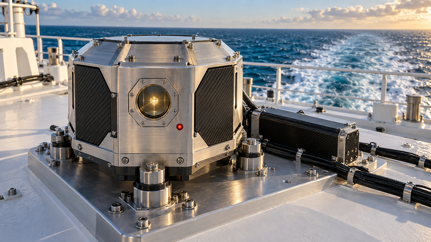
A 29-meter vessel worked its way through the Coral Sea off Australia's east coast this year with GNSS observations withheld from its navigation solution, tracked within roughly one nautical mile for the first 70 kilometers, and finished the 83-kilometer route knowing where it was to within 2.2 nautical miles. The instrument that kept it honest was a quantum gravimeter riding in a passenger cabin, measuring the faint hills and valleys in Earth's gravity field and matching them against a preloaded satellite-derived gravity map. Sydney-based Q-CTRL announced the trial on August 27, describing it as the first open demonstration of gravity-map navigation with no GNSS observations anywhere in the measurement, map-matching or correction chain, no periodic sensor recalibration and no special installation infrastructure.
The claim is checkable because the company posted the technical manuscript a day earlier. Patrick J. Everitt, Donald H. White, Todd Lyon, Murat Muradoglu and eighteen colleagues describe the system and the sea trials in arXiv:2608.25563, "GNSS-free quantum gravity-aided navigation and fine-scale marine surveying with a strapdown quantum gravimeter," submitted August 26, 2026. The paper carries the numbers a buyer would want: position error bounded near one nautical mile for the first 70 kilometers of the traverse and 2.2 nautical miles at the 83-kilometer endpoint, where the navigation-grade inertial system running unaided ended near 14 nautical miles — a 6.3-fold endpoint reduction — with separate GNSS-referenced surveying passes taking the sensor through conditions up to Sea State 4.
How Gravity Map Matching Corrects an Inertial System's Drift Without Emitting a Signal
Ships and aircraft equipped for it already carry the fallback for lost satellite signals: an inertial navigation system, a package of accelerometers and gyroscopes that integrates motion from a known starting point. Its flaw is arithmetic. Tiny sensor biases compound as the integration runs, so position error grows with every hour away from a fix. A vessel relying on a navigation-grade inertial unit alone can wander miles off its dead-reckoned track in a day. Something external has to discipline the drift, and for decades that something has been GPS.
Gravity offers a different external reference, one that comes from the planet itself. Earth's gravity field varies subtly from place to place, shaped by seabed topography, crustal density and deep structure, and those variations are charted in satellite-derived anomaly maps that cover the world's oceans. A vehicle that measures local gravity precisely enough can compare what it feels against the chart and pull its inertial estimate back toward truth. The concept has circulated in navigation circles for decades; the missing piece was a gravimeter accurate enough to be useful and rugged enough to work on a moving ship without an entourage of stabilization hardware.
Q-CTRL's answer, the Ironstone Opal system, hybridizes a cold-atom interferometer with a classical accelerometer and a navigation-grade inertial unit. The atomic measurement interrogates falling atoms with laser pulses, a physics reference that does not age or drift the way a mechanical spring or electromechanical sensor does, and it continuously corrects the classical channel. In a 56-hour stationary test reported in the paper, that atomic referencing cut the long-term bias drift roughly seventy-fold compared with the classical accelerometer running alone. Software carries the ruggedization: the company's AI-driven control stack stabilized the quantum sensor against the ship's motion, so the unit ran autonomously in an ordinary cabin with no dedicated environmental temperature control, no gyroscopic isolation platform and no recalibration stops.
What the Coral Sea Trial Measured: 2.2 Nautical Miles at the Endpoint, Sea State 4 in Survey Mode, and a Map 50 Times Finer
The trials had two products, and the second matters as much as the first. The headline result is the navigation run: position error bounded near one nautical mile for the first 70 kilometers and 2.2 nautical miles at the 83-kilometer endpoint, where the same data run on the inertial system alone ended near 14 nautical miles off — 6.3 times farther. The quieter result is surveying, gathered in separate GNSS-referenced passes. As GPS World reports, the instrument resolved gravity anomaly features at roughly 300-meter scale along track, some fifty times finer than the satellite-derived baseline maps, agreeing with those maps at the milligal level and repeating its own passes to better than a milligal.
That surveying capacity closes a loop the whole approach depends on. Gravity navigation is only as good as its charts, and today's open-ocean charts come from satellite altimetry at kilometer-scale resolution. A sensor that both navigates against the existing map and gathers a far finer map while underway means every transit can sharpen the chart the next transit steers by. The paper frames the two functions as one instrument doing double duty, and for mission planners the implication is that map quality, the main external limit on accuracy, is improvable with use.
Quantum pillar: sensing (inertial navigation and PNT). Use posture: dual-use. Technology readiness: TRL 6 of 9. A complete prototype navigated an open-sea mission autonomously in realistic conditions, and qualification, endurance across vessel classes and operational acceptance still lie ahead of it.
Why 978,000 Jamming Events in One Quarter Make Passive Navigation a Program Priority
The demand signal behind this work is measured, and it is large. Q-CTRL cites roughly 978,000 GPS jamming events worldwide in the first quarter of 2026 alone, 98 percent of them concentrated in the Middle East, touching more than 1,100 vessels; The Quantum Insider's coverage sets the trial against the Strait of Hormuz, where deliberate jamming and spoofing disrupted shipping across the region this year. Spoofing is the sharper threat, because a receiver that is fed a false position may act on it confidently, and commercial tankers have run aground on exactly that failure.
What a gravimetric navigator changes for a force is the geometry of that fight. The system emits nothing and receives nothing over radio, so there is no signal to jam, no waveform to spoof and no emission for an adversary to detect and target. Jason Ralph, professor of electrical engineering and electronics at the University of Liverpool, put the distinguishing feature plainly in the announcement: among the alternative navigation technologies, gravity sensing with map matching is the one passive option that is global in extent and cannot be interfered with from outside. Retired Lieutenant General Steven A. Sklenka, formerly the U.S. Marine Corps deputy commandant for installations and logistics, drew the operational line: distributed maritime operations and contested logistics need positioning that survives the moment GPS is denied, which he treats as a matter of when.
The posture reading is dual-use in both directions. The same instrument keeps a commercial tanker off the rocks in a spoofed strait and keeps a naval resupply convoy on course through a contested one, and GPS-denied navigation is an enabler for whatever mission the platform carries rather than a weapon or a shield in itself. Q-CTRL's publicly named partners and programs make the split explicit: DARPA, the U.S. Defense Innovation Unit, Australia's defense department and the UK Royal Navy on the defense side, with the company's magnetic-field sibling system, MagNav, already flown in ground and airborne trials in 2025 and working toward commercial aviation alongside partners including Airbus and Lockheed Martin.
What Still Stands Between a Sea Trial and a Fleet: Maps, Endurance and Accuracy Classes
A program office reading this result should register both what it establishes and what it leaves open. It establishes that a strapdown quantum gravimeter can navigate a small working vessel through roughly six hours and 83 kilometers of real seas without GNSS observations in the navigation solution and without special accommodation, with a separate 56-hour stationary test documenting the roughly seventy-fold drift suppression underneath that result. Those were precisely the failure points that kept gravity navigation theoretical since the concept first circulated, and a peer-reviewable manuscript with 22 authors now documents their removal in one trial campaign.
What remains open is scale in three senses. First, geography: performance depends on gravity map quality and on how distinctive the local gravity terrain is, and a trial corridor off eastern Australia does not certify the flat gravity landscapes of some open-ocean basins, where map matching has less to grip. Second, endurance and platform class: an 83-kilometer traverse on a 29-meter vessel is a demonstration, and submarine patrols or trans-Pacific transits will demand months of unattended operation on platforms with different vibration and motion signatures. Third, the accuracy class: nautical-mile-class positioning is a strong fallback for ships and aircraft, and it is far from the tens of meters that precision approach, littoral maneuver or weapons-grade positioning require, so gravimetric navigation slots in as the resilient layer under finer intermittent fixes rather than a full GPS replacement.
The procurement questions this trial makes askable are concrete. A vendor offering assured positioning, navigation and timing should now be asked whether its gravimetric channel runs strapdown or requires a stabilized platform, what its measured drift is with the atomic reference engaged, which gravity maps it ships with and how it improves them in service, and what its demonstrated sea-state envelope is. Those questions have published benchmark answers as of this week: strapdown, roughly seventy-fold drift suppression, milligal agreement with satellite charts, Sea State 4 in survey mode. The next result worth watching is the same system on a longer route, a rougher sea or an undersea platform, and the manuscript now on arXiv is the baseline it will be measured against.
Sources
Primary source: Patrick J. Everitt, Donald H. White, Todd Lyon, Murat Muradoglu and eighteen colleagues at Q-CTRL, 'GNSS-free quantum gravity-aided navigation and fine-scale marine surveying with a strapdown quantum gravimeter,' arXiv:2608.25563, submitted August 26, 2026. Other material: Q-CTRL's trial announcement of August 27, 2026; Tracy Cozzens's report for GPS World (August 28, 2026); Matt Swayne's report for The Quantum Insider (August 27, 2026).